Hiking the Lost Valley Trail, Natural Stone Bridge, Waterfalls, and Waterfall Inside a Cave! This Upper Buffalo National River Destination is not to be Missed!
Hiking Lost Valley Trail: Waterfalls & Caves in Arkansas
Hiking Lost Valley in Arkansas offers a stunning trail with waterfalls, caves, and a natural stone bridge. Explore this must-see Buffalo National River hike.
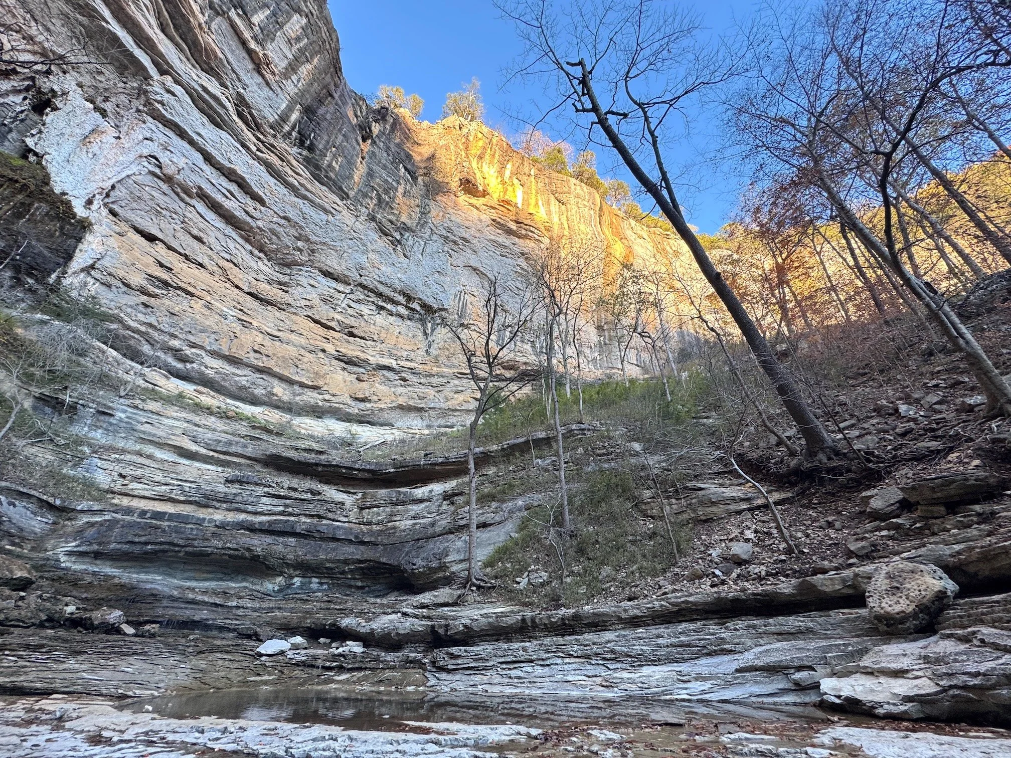
The Lost Valley Trail, located near the Buffalo National River in Arkansas, is a scenic and popular hiking trail that offers offers a lot in its roughly 3 miles of length. The trail climbs alongside Clark Creek, and past striking river and rock formations. The formations include:
Jigsaw Blocks, where the riverbed looks like a giant collection of jigsaw blocks that have been put together.
Natural Bridge is a natural stone arch that Clark Creek passes under and then cascades down a small waterfall
Cob Cave, a large overhanging area carved out by Clark Creek in a turn of the river
Eden Falls, a 53-foot tall cascade that empties into a beautiful emerald pool; and
Eden Falls Cave, which requires you to crawl on your hands and needs for several hundred feet underground to reach the waterfall inside the cave!
The majority of the trail is an easy to moderate walk, though the difficult and roughness of the route increases after Cob Cave and is the most difficult as you approach the Eden Falls Cave. The climb through the cave is not difficult, but it does require crawling or butt scooting and can be very claustrophobic. The entrance to the cave is also in a very steep, muddy, and wet area at the top of Eden Falls, which can be challenging for those who don't like heights like Jeff.
Trail Description: The Lost Valley Trail begins at the end of Lost Valley Road, where the National Park Service has constructed a large parking area. From the rear of the parking lot, a very well maintained trail travels up the valley and in about one tenth of a mile you’ll reach an open area that includes a pavilion, a restroom with running water, and a privy. There are also two kiosks with trail and site information. From the upper end of the field, the trail crosses Clark Creek and then follows a well constructed and maintained path along Clark Creek. Along the way there are benches of informational signs. The first of the natural formations you’ll come to is the Jigsaw Blocks, which make up the stream bed of Clark Creek (on the right). The trail continues upstream, but comes to a trail junction about a mile into your walk. At this point the trail makes a loop, with the trail to the right descending to the banks of Clark Creek and then making its way, via a more rugged and moderately difficult hike up the creek past the Natural Bridge, Eden Falls, and then Eden Falls Cave. From the Cave, you’ll be able to then descend the other side of the loop, avoiding the stairs and most of the rugged terrain. We took a right (counterclockwise around loop), descended to the creek, and then reached the Natural Bridge and its attendant waterfall quite quickly. From there, the trail climbs again, past Cob Cave and then to Eden Falls. From Eden Falls, the trail climbs quite steeply to the top of the Falls, passing a trail junction with the other portion of the loop trail (stay right) and ends at the entrance to the Eden Falls Cave. From the cave entrance, it’s about 300 feet or so of crawling through a wet and very dark cave (you will NEED headlamps and/or flashlights)to reach the waterfall at the back of the cave. From the cave, you descend a bit to the trail junction and stay to the right/straight ahead, instead of descending to the left (don’t go the way you came up from Eden Falls). The trail descends more moderately back to the first trail junction you came to (stay to the right and then you follow the same trail you came up back to the trailhead parking area.
The total distance is 3 miles round trip. The majority of the trail is easy to moderate, with the section from Eden Falls to the Eden Falls Cave more moderate to challenging, while the climb through the cave to the waterfall can be anywhere from easy to difficult depending upon how you feel about crawling through a cave.
This is a popular area and is one of those must visit locations when you're in the Upper Buffalo National River area. We did the hike early in the morning to beat the crowds, but by the time we were going back down to the parking area, the crowds had definitely begun to pick up.
The Oklahomo Hiker was our guide to this beautiful area and contributed some great video of the Eden Falls Cave when Jeff wouldn't go any further!
For More Information
You can find out more about this this hike here:
Don’t miss our YouTube Playlist to hiking the Ozarks and Arkansas waterfalls.
Our Hiking Advice and Hiking Gear Recommendations
Gear we used on this hike:
Some product links are affiliate links and we earn from qualifying purchases. Others are links through the Amazon Influencer program and as an Amazon Influencer, we earn from qualifying purchases. Still others, we just want you to know about some good gear we enjoy!
Important Hiking Considerations:
Weather: Check the weather forecast before your hike and be prepared for changes in conditions.
Safety: Some sections of the trail can be steep and rocky, so use caution and watch your footing.
Leave No Trace: As with any outdoor activity, remember to follow the principles of Leave No Trace. Pack out any trash, stay on the trail, and be respectful of the natural environment.